I
From Wikipedia – Death Valley is the hottest, lowest, and driest place in the United States, with daytime temperatures that have exceeded 130 °F (54 °C). The park protects Badwater Basin and its vast salt flats located at the lowest elevation in North America, −282 ft (−86 m). The park also protects canyons, badlands, sand dunes, mountain ranges, historic mines, springs, and more than 1000 species of plants which grow in this geologic graben.
- Established: 10/31/1994
- Annual Visitors: 1,678,660
- Size: 3,372,981 acres
May 7, 2021
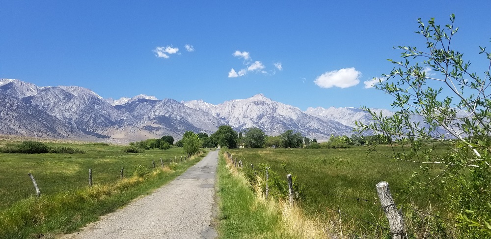
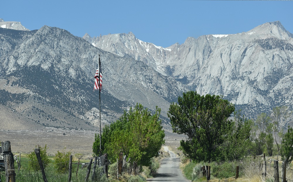
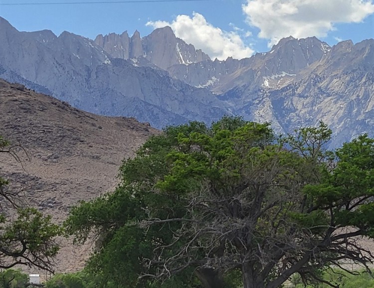
Making our way to Death Valley National Park, we stayed in Bakersfield, CA one night so I could catch up with my younger step brother. A visit way over due and very appreciated by us both. We were originally going to go directly to Death Valley but, a couple days ago, decided to head out for Lone Pine, CA and Mount Whitney. Gary has climbed Mount Whitney twice and I have never been to the area. I was excited to see where he had great experiences.
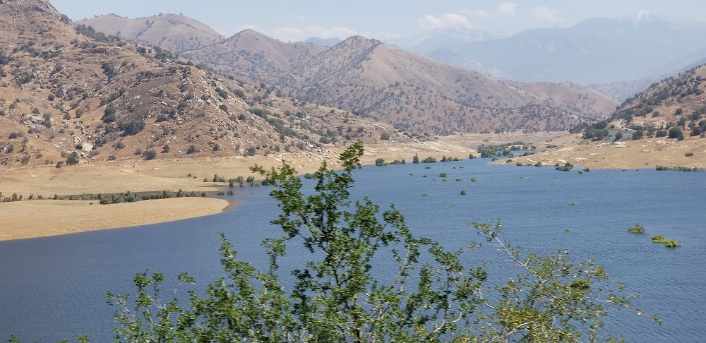

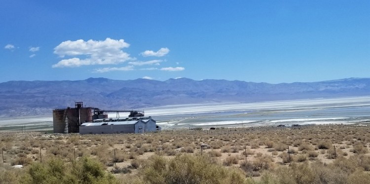
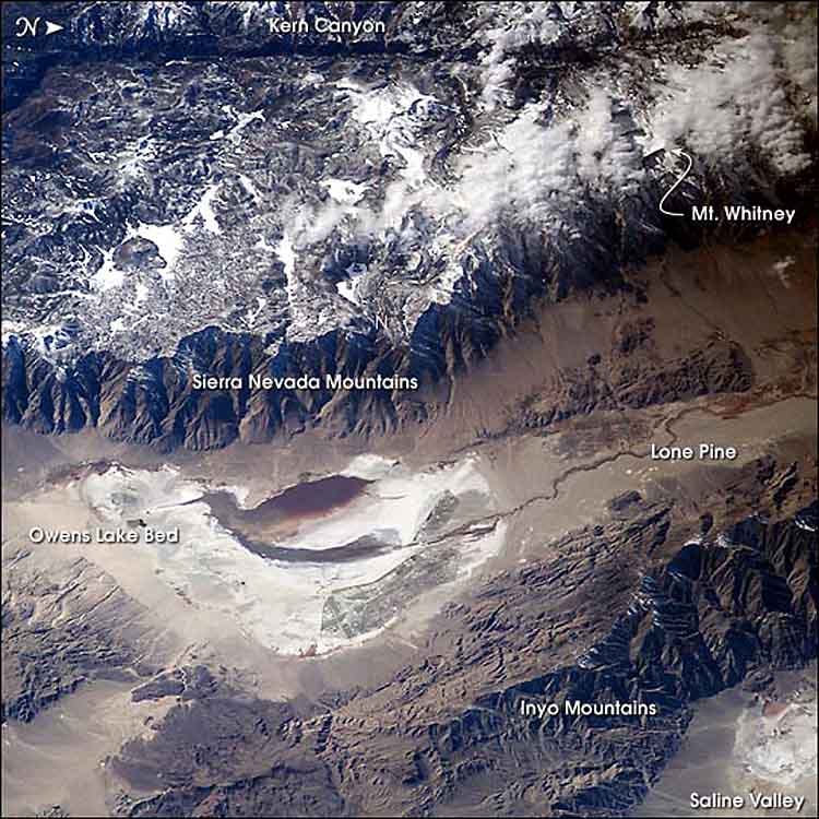
South of Lone Pine is Owens Lake with an interesting presentation and history.
According to Wikipedia:
“…Owens (Lake) held significant water until 1913, when much of the Owens River was diverted into the Los Angeles Aqueduct, causing Owens Lake to desiccate by 1926. Today, some of the flow of the river has been restored, and the lake now contains some water. Nevertheless, as of 2013, it is the largest single source of dust pollution in the United States. The lake was the epicenter of a magnitude 5.8 earthquake that occurred on June 24, 2020…The lake is currently a large salt flat…”
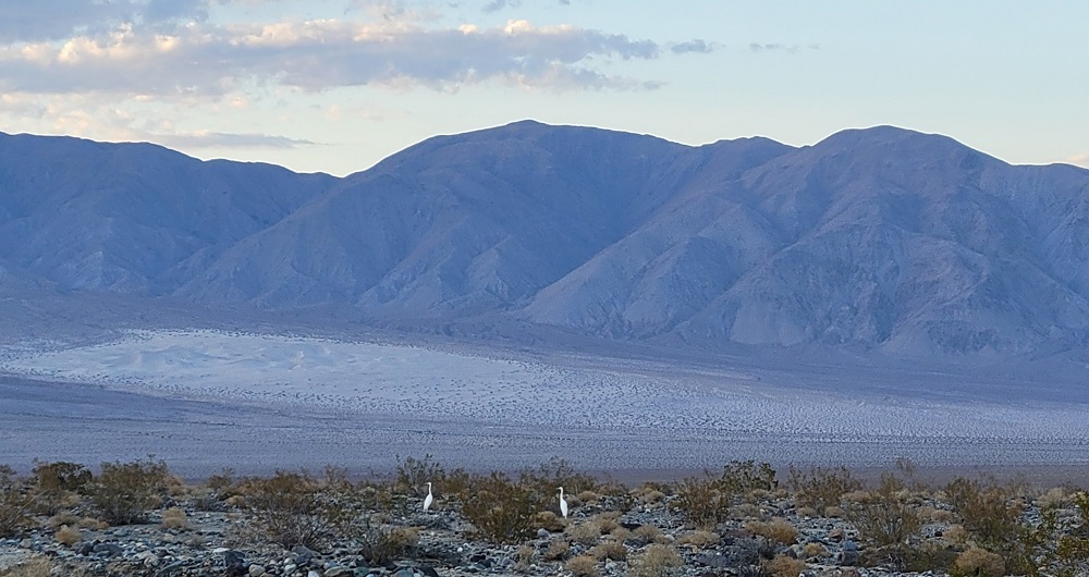
Owens Lake is owed by Los Angeles Department of Water and Power, California State Land Commission, California Department of Fish and Wildlife and some acreage is privately owned. As you can see from the photos we took and the one taken from the International Space Station, the lake is mostly marsh and salt flats. Portions of the water turn a brackish and red brown color due to the saline and mineral levels in the ground. I was intrigued by the lake’s varying colors and a variety of fence like partitions throughout the 17-mile-long, 10 miles maximum width and the mere 3-foot depth at its deepest section.
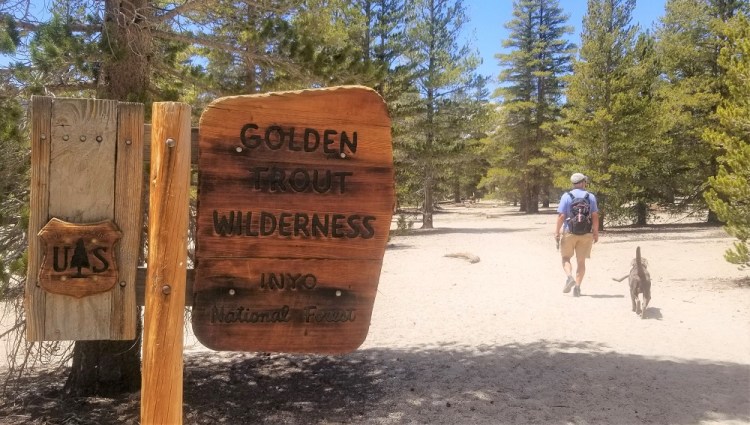
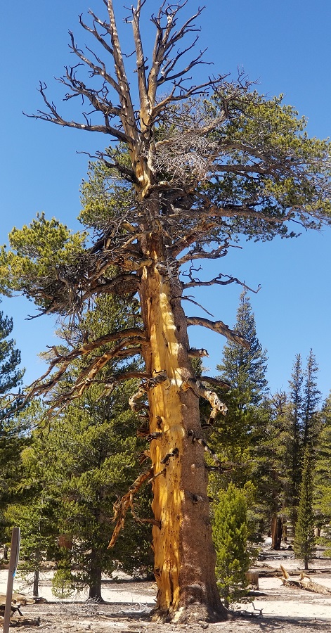
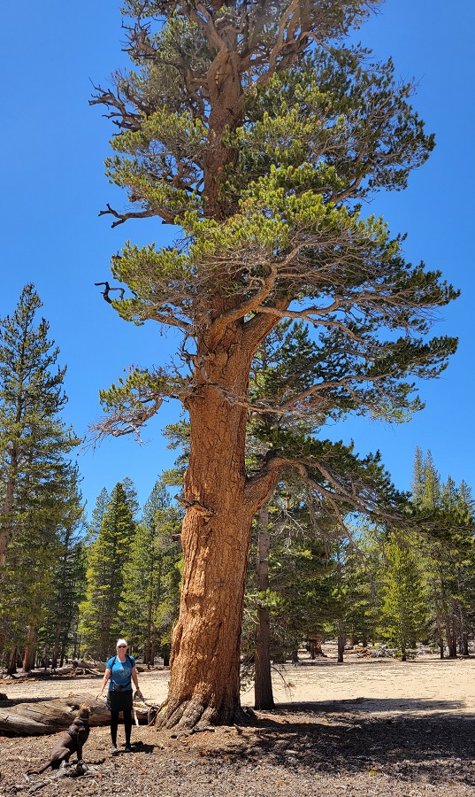
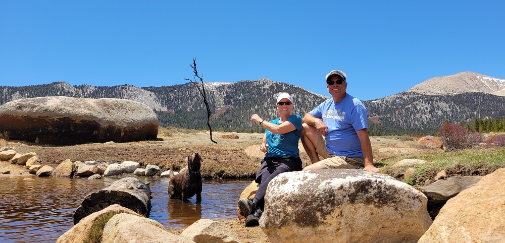
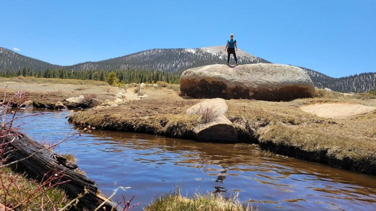
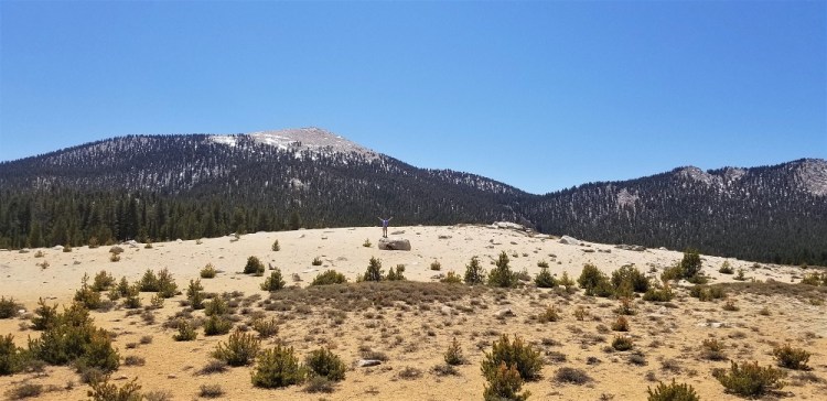
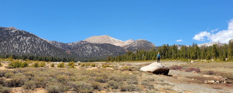
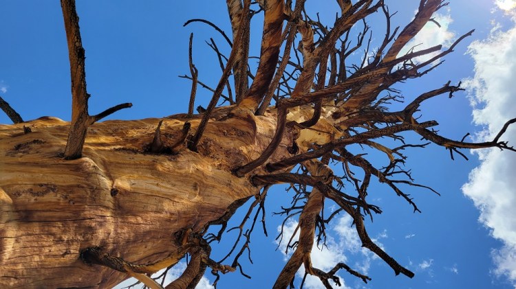
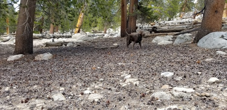
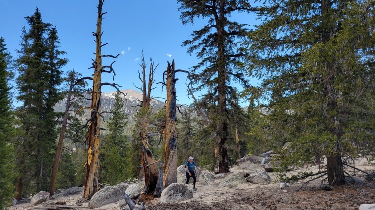
Before checking into our hotel, we drove from Lone Pine’s 3,700 feet and 84 degrees, up to 10,000 feet and 55 degrees. The drive was about 20 miles and took roughly 40 minutes for that drastic climate change. Our hike took us across to Horseshoe Meadows, in the Golden Trout Wilderness Area, inside the Inyo National Forest within the Eastern Sierra Mountains…phew! : ) Another amazingly sunny day, which we have been blessed with this entire trip! We ventured into the area where Gary camped the night before both of his guided climbs to Mount Whitney’s summit. This was one of the few times in my life I have hiked in elevation over 10,000 feet. I have been to the top of Mount Humphreys (12,635) in Flagstaff, AZ and have driven over 10,000 feet a few times. Besides a few huffs and puffs going up a slight hill, I did OK!
Gary took me to Mt. Whitney Restaurant in the quaint downtown area of Lone Pine, population 2,000. He has eaten there with his climbing buddies previously. Their movie memorabilia and the variety of hamburger meat selections made this restaurant interesting. Your choices were elk, ostrich, buffalo or beef. The staff was great, dog friendly patio, and the Mojave Red Ale by California’s Indian Wells Brewing Company hit the spot. My beef hamburger, topped with red onion, pineapple and teriyaki sauce with a side of green salad and Gary’s pastrami and cheese topped beef burger finished the day off with a smile. We have eaten all of the above options of meat in the past but chose to go the traditional route this evening : )
May 8, 2021 – Lone Pine to Death Valley
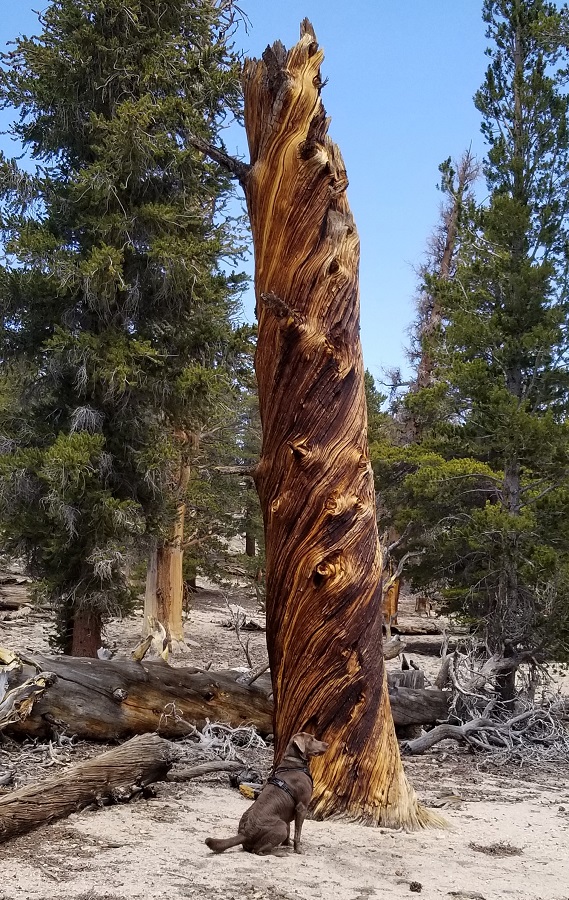
Our first walk in the wild this morning was in the Alabama Hills, 30,000 acres of public lands. 18,000+ acres of which was designated as a national scenic area in 2018. The Lone Pine residents, including those on the Lone Pine Reservation just outside the hills, and a conservancy organization have worked very had to protect and preserve this sacred and more recent, famous movie filming location. Beginning in 1920, over 400 movies have been filmed in the Alabama Hills, the surrounding area and in the town of Lone Pine. The name came from the Confederate warship C.S.S. Alabama. Civil War Confederate supporting prospectors were mining in the area and named the hills, the name was never changed. The strikingly different shape of these hills are made from wind erosion and natural chemical changes due to weather.
Our first venture into the rocks took us to Mobius Arch. We climbed amongst the boulders and then drove by many of the famous western filming locations. It would have been really fun to have been in Lone Pine, in the early to late 1900’s, running into Gene Autry, Hopalong Cassidy, or the Lone Ranger enjoying a beer at the local watering hole! Or being a local resident movie extra in Gladiator or Iron Man!
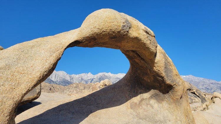
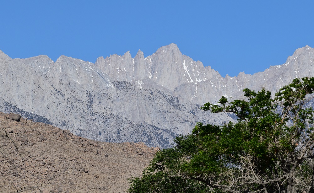
Mt Whitney seen through the Mobius Arch 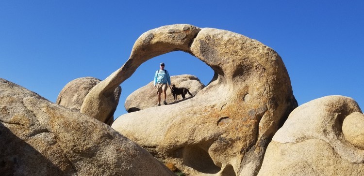
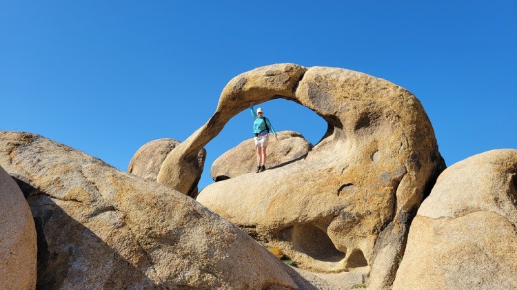
Elizabeth trying to stay steady as the winds howl 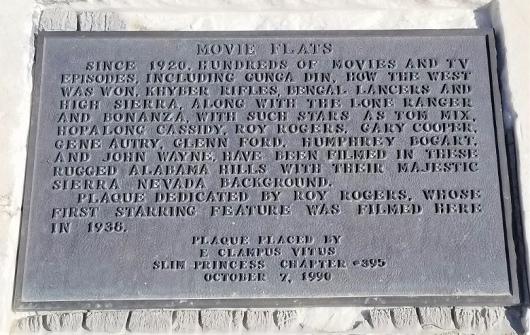


Gary and Rangeley hiding amongst the rocks 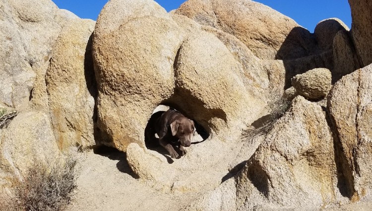
Rangeley crawling through an opening in the rocks 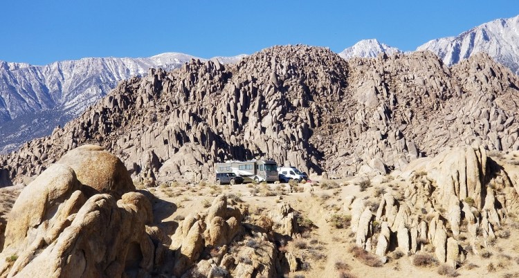
The contrast in the hills is why this was a popular place to film westerns 
Hobbit Hill. Not really, but we thought it would be a good name. 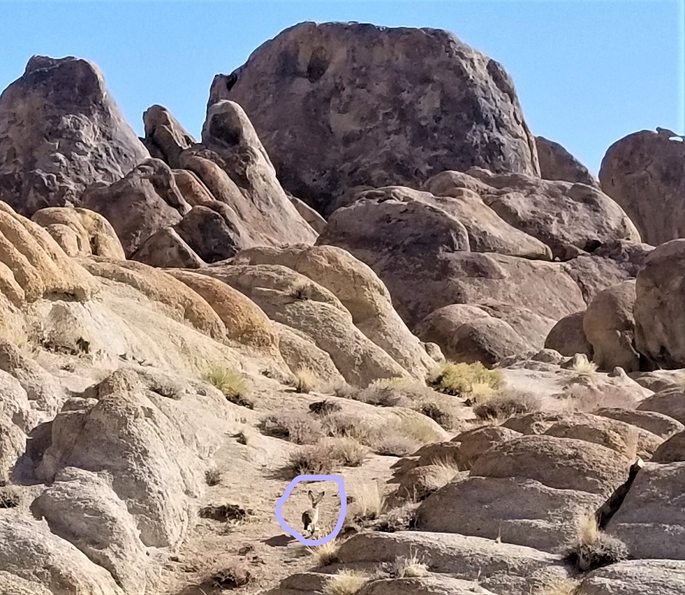
Mr. Jack Rabbit out for his morning walk. 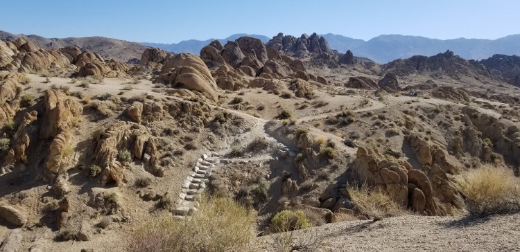
Lots of wonderful trails weave through the various rock formations. 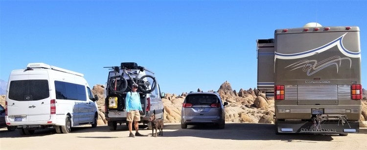
We are truly driving a “mini” van. It works great for us. Much easier to park than these other guys.
We then drove 14 miles up to the Whitney Portal. It was 78 degrees in Lone Pine at 3,700 feet and 52 degrees at 8,400 feet at the Portal. We hiked a mile plus up the Whitney Trail and had fun talking with day hikers, backpackers out for a night or two and some returning from conquering the Mountaineer’s Route to Whitney’s summit of 14,508 ft., the same route Gary has done twice. Rangeley loved the couple of streams we came across. Since I have never been to Mt. Whitney, I really enjoyed the hike as well as visually seeing where Gary’s climbing stories came from.
Mt. Whitney. Gary has actually climbed up the chute with snow just to the right of the summit on a previous visit. 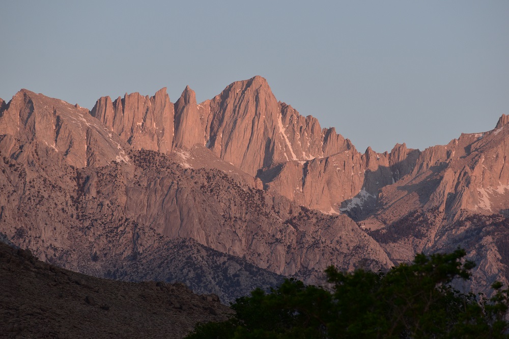
Sunrise on Whitney 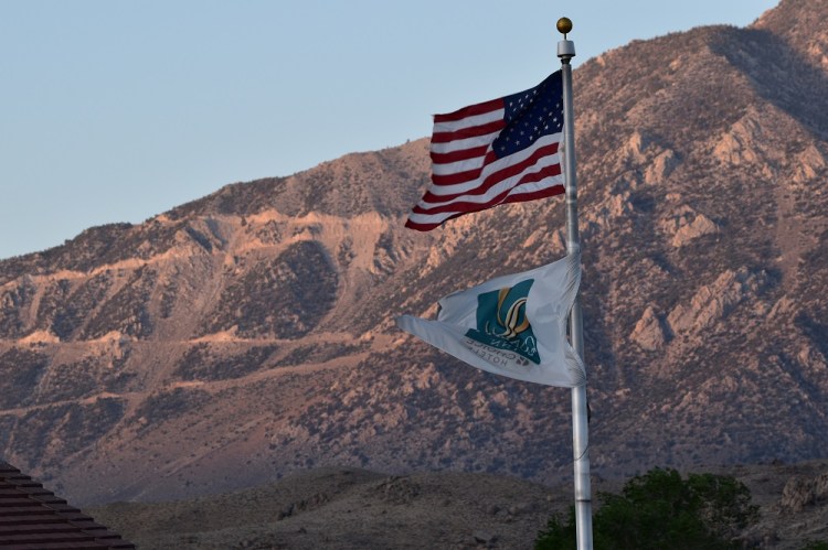
Sunrise on the road to Horseshow Meadows we drove yesterday. 
A beautiful field of lupines 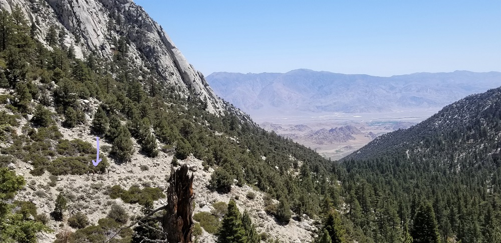
Hiking up the Whitney Trail. The arrow is pointing at other hikers for perspective comparison. 
Rangeley sure loves his streams 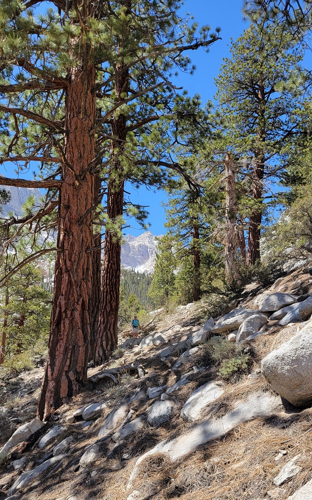
Elizabeth heading down 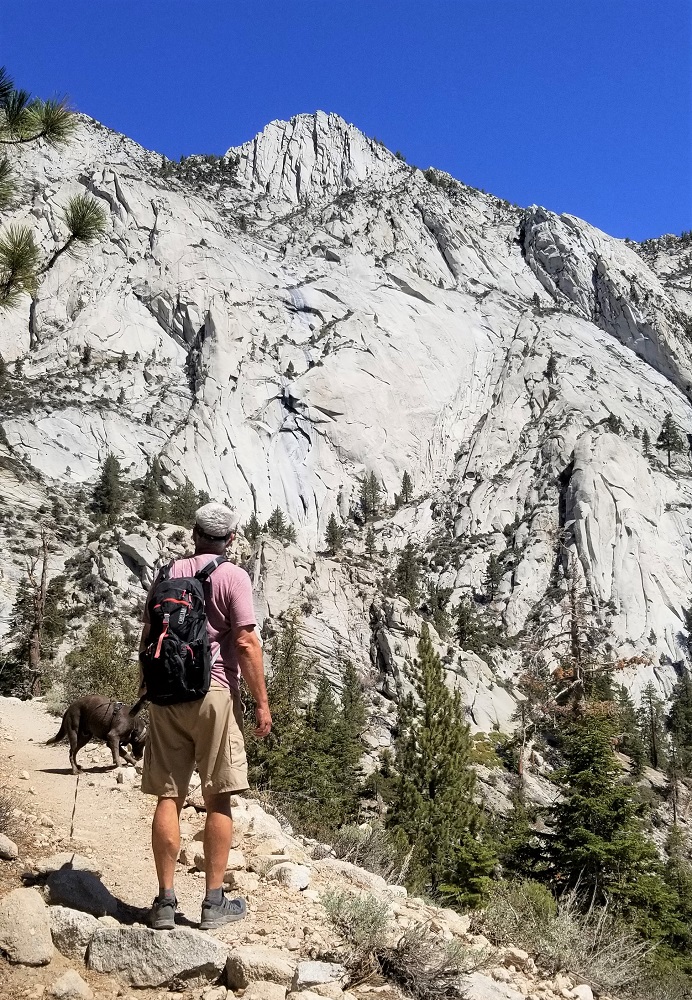
Gary scanning an area he climbed on the Mountaineers Route in the past. We hiked the Whitney Trail. (The bottom mile is the same trail.) 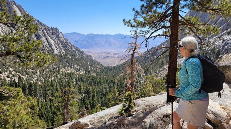
Looking down toward Lone Pine. 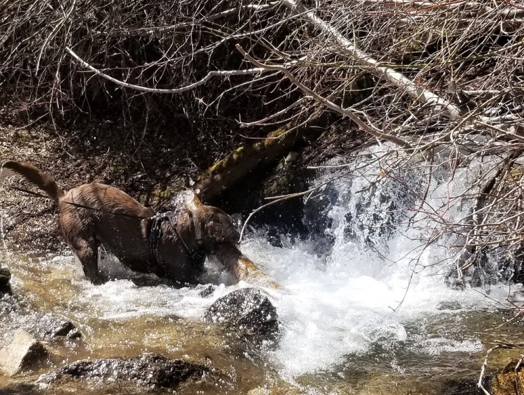
A second chance at the streams on the way down. 
This is just above the split of the Whitney Trail and the Mountaineers Route.
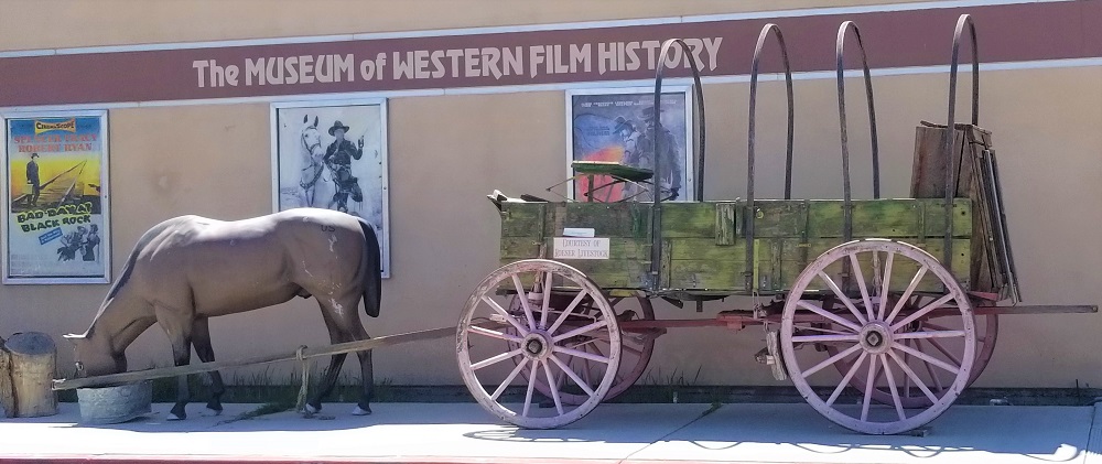
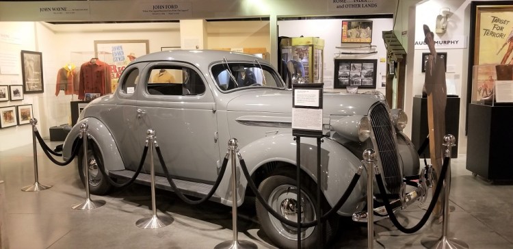
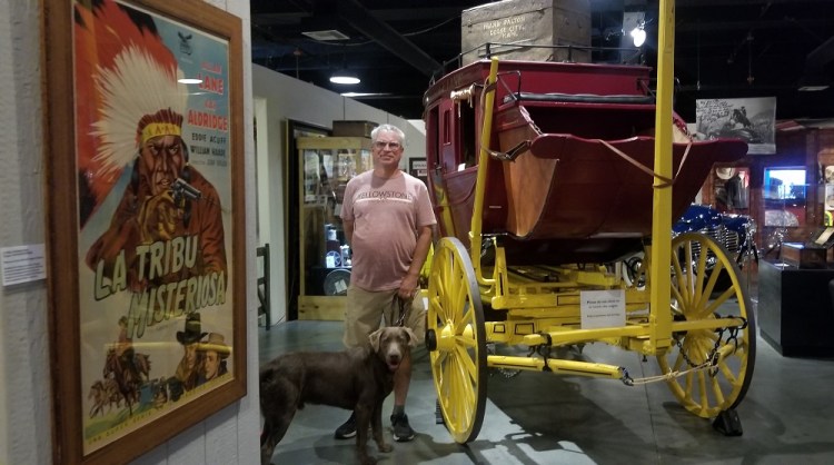
After lunch at The Whiney Portal Store, we returned to Lone Pine to tour The Beverly and Jim Rogers Museum of Lone Pine Film History. Also known as the Museum of Western Film History. They had a well done looping informative video about the Alabama Hills and its film history. Rangeley was allowed in the museum with us like when we were in Roswell last fall and took him to the UFO Museum : )

I loved the old cars! Humphry Bogart drove this 1937 Plymouth Coupe in the movie High Sierra (1941), filmed halfway up Mount Whitney.
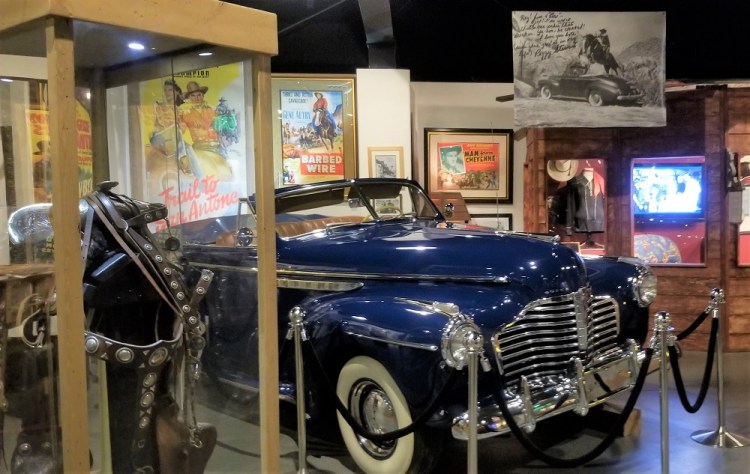
See Gene Autry’s stunt double jumping a horse, over this original car in the museum, while actress Peggy Stewart was in the backseat. Her signed picture in upper right corner is one of many items she’s donated to the museum.
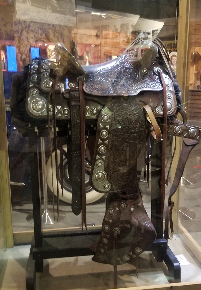
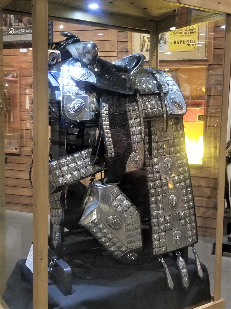
Two beautiful leather and silver parade saddles
Gary and Rangeley in the museum
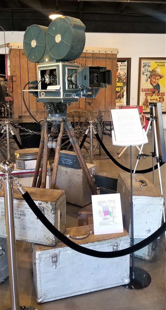
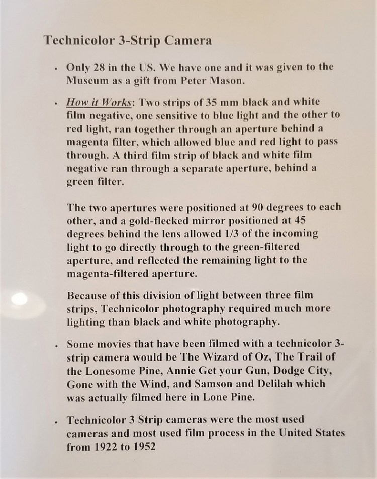
A recently acquired, rare Technicolor Three Strip Camera. It is only one of 28 in the United States.
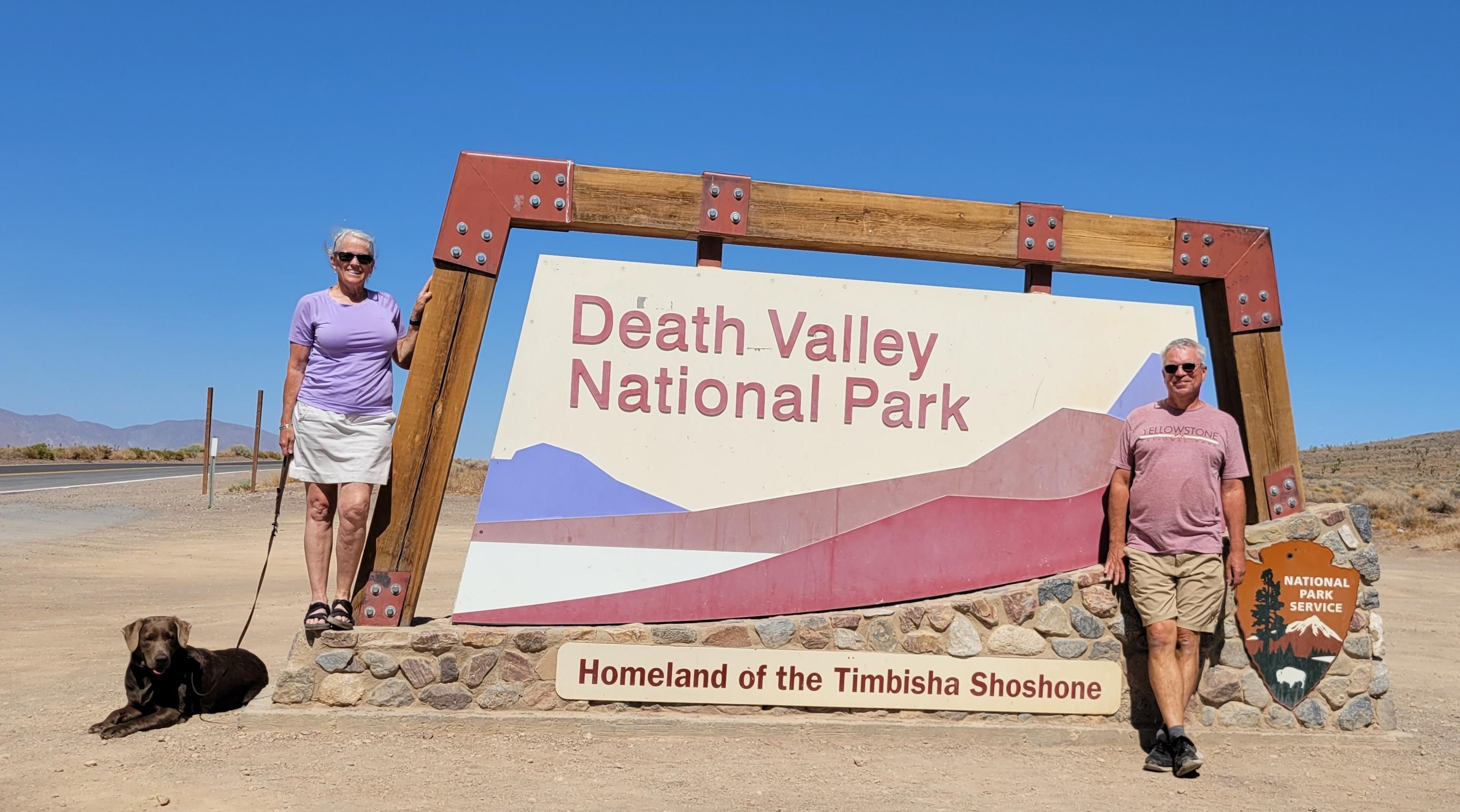
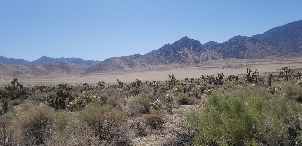
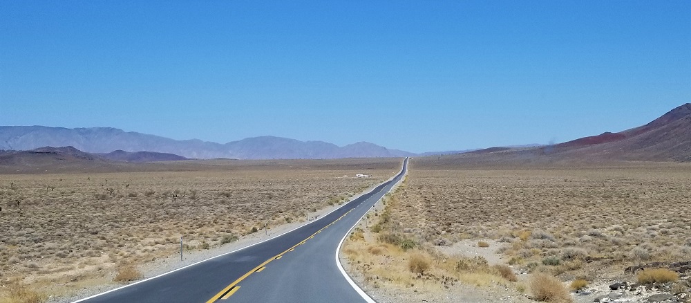
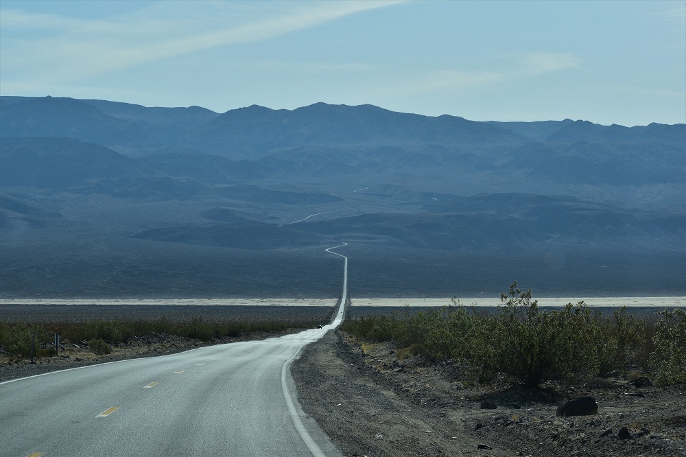
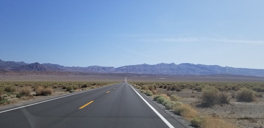
Saying goodbye to Lone Pine we drove a very desolate 40 mile road toward the town of Panamint in Death Valley National Park. The park’s entrance sign is at about 4,000 feet.
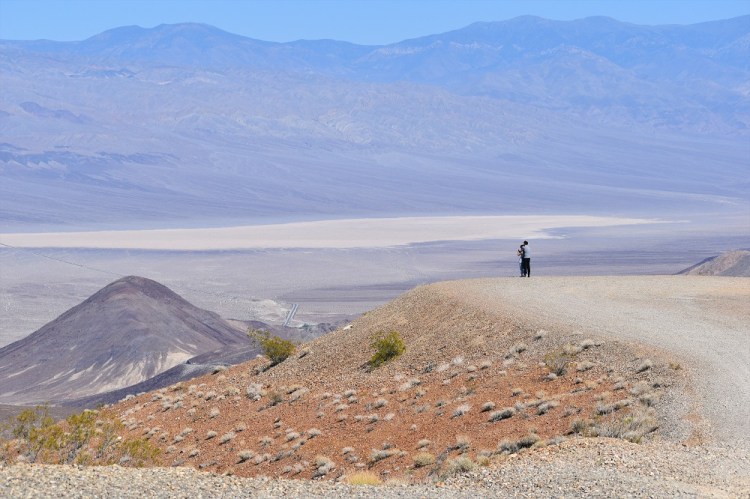
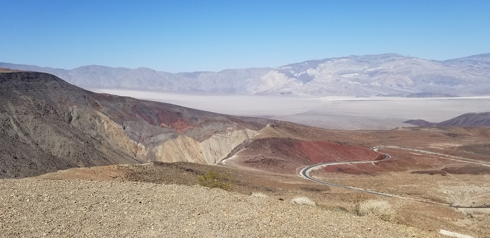
We stopped at Father Crowley Vista Point, overseeing the Panamint Mountains and viewing Rainbow Canyon on the far western side of the park. During the week, this location is the air space for training fighter jets but we were there on a Saturday.
Saturday afternoon traffic on the way to Death Valley : ) It was a little lighter than going into Great Smoky Mountains. 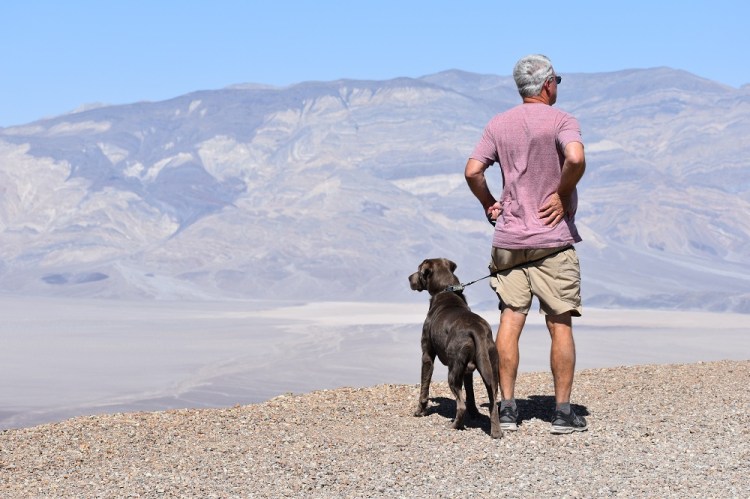
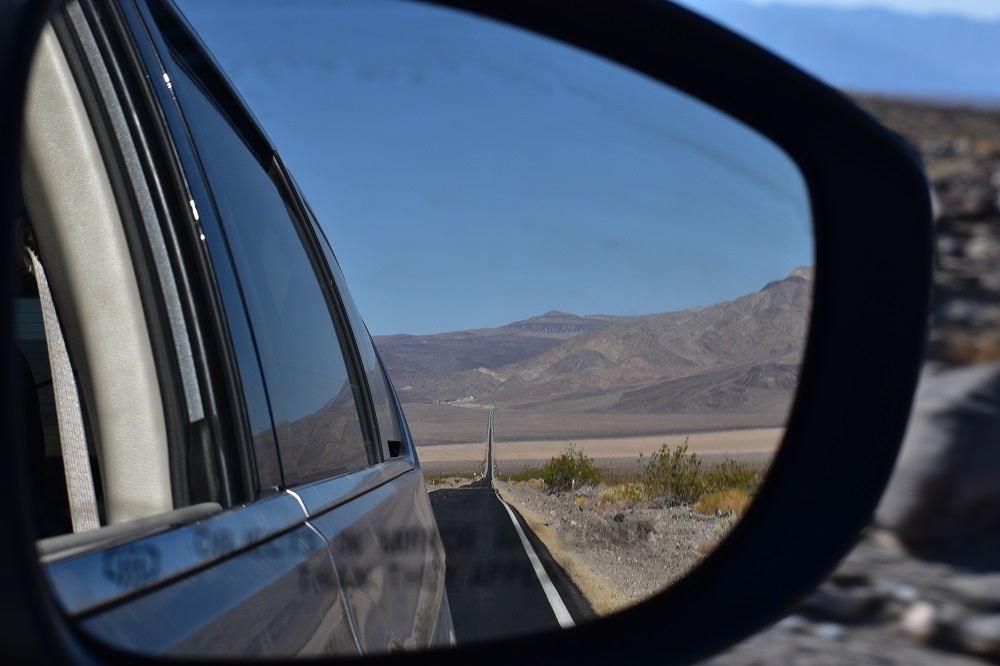
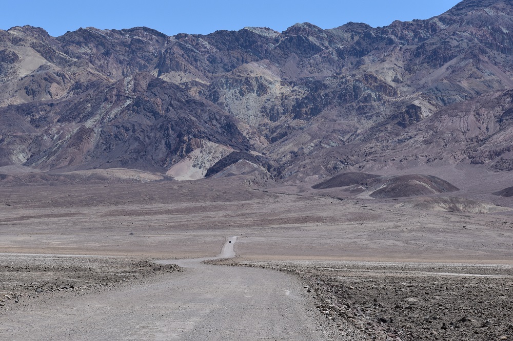
At 4,000′ looking down into the valley almost 3,000′ below. Badwater is still about 70 miles away. 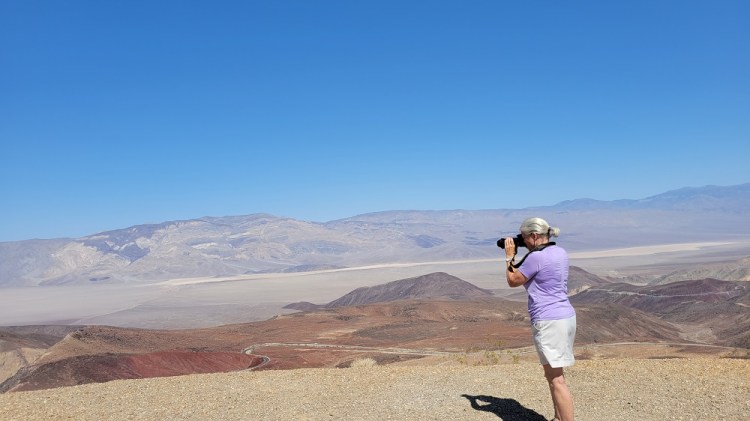
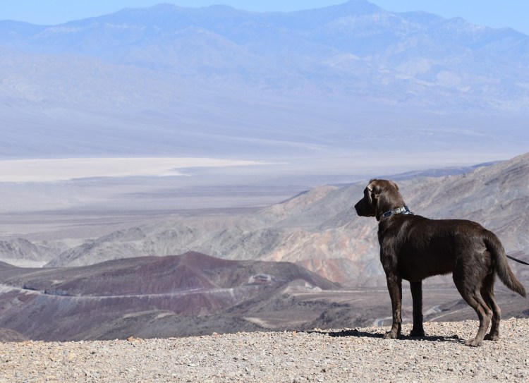
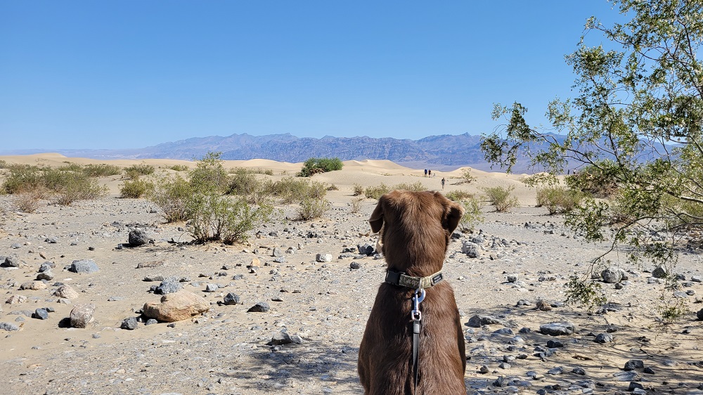
Rangeley truly looks out at views. He was watching the cars on the road below. 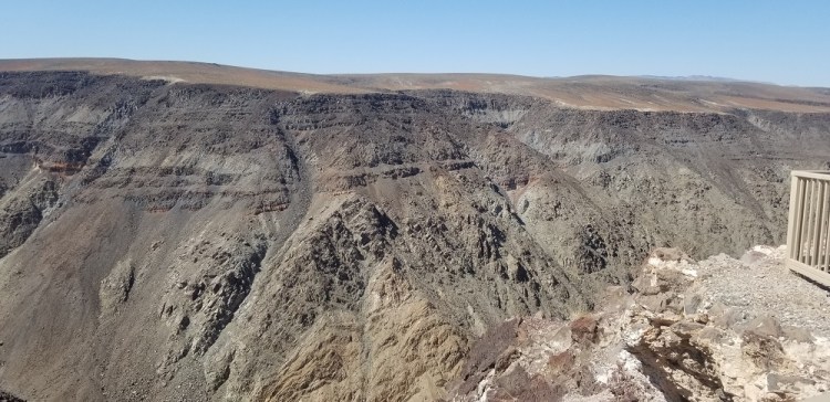
Rainbow Canyon 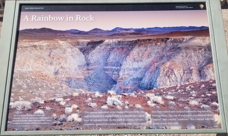

A young couple enjoy the private views 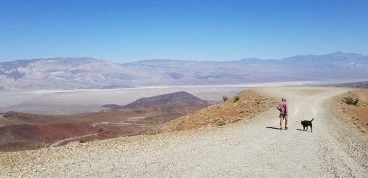
The road below us heading down into Panamint Springs 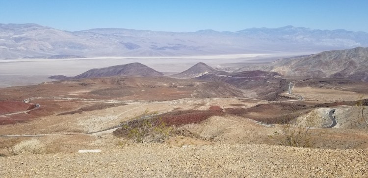
The road down into the valley. 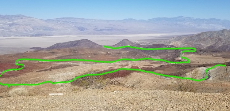
Now you see the road
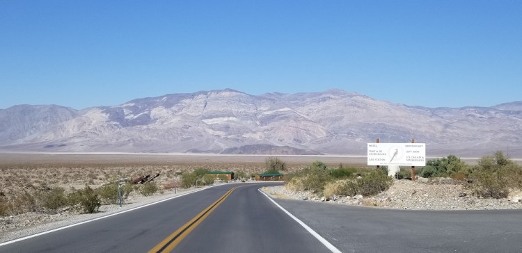
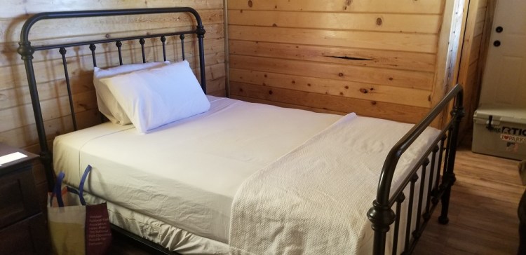
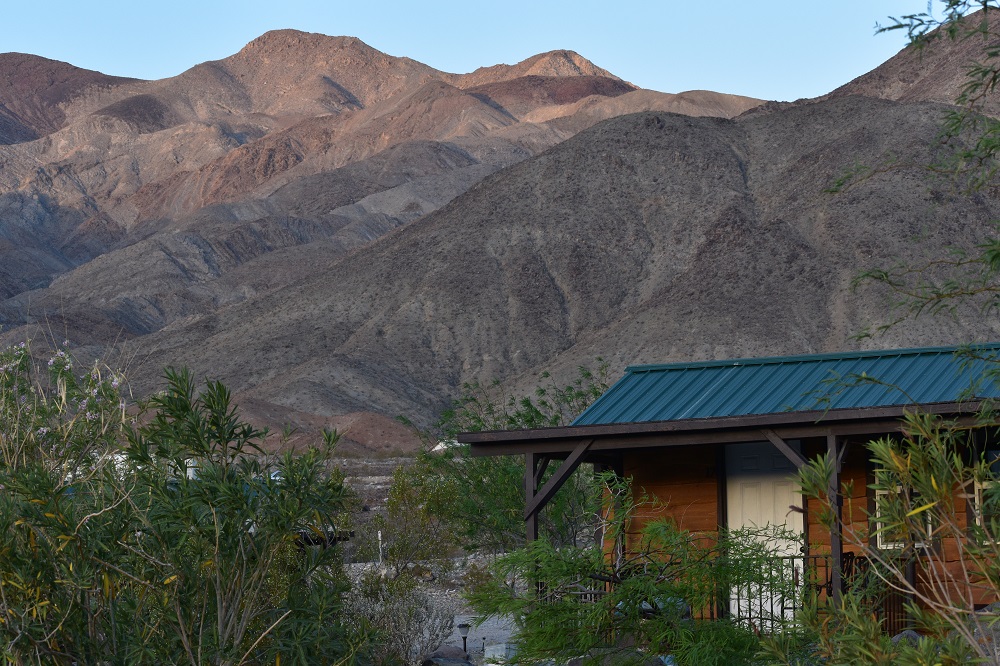
From 4,000 feet at the above location, we descended into Panamint Spring, CA. Built in 1937 by a talc miner. The owner Cody Reid, a cousin of William “Buffalo Bill” Cody, Mr. Reid built a hotel and restaurant for travelers going from Stovepipe Wells, CA to Darwin, CA on this desolate stretch of road. During 1959-1992 Panamint has been bought and sold a few times. Since 2006, Panamint Springs Resort has been owned and operated by the Cassell Family. This 40 acre rustic resort is home to a store, restaurant, RV park, hotel rooms, tent cabins, wooden cabins (where we stayed) and 360 degree mountain views!


We enjoyed a dinner and I with a Prickly Pear (cactus) Margarita and Gary with his local draft beer in hand relaxed in the quiet town on the Mexican restaurant’s patio. The temps were in the low 90’s but being over 2,000 feet in elevation and a slight wind, we were quite comfortable in the shade. We shared the sunset with a few campers after a walk in the desert. Tomorrow we play tourists again stopping at a few highlights of this interestingly diverse landscape of mountains all around and the lowest spot in the US, Badwater Basin.
May 9, 2021 – Day 2 in Death Valley
Happy Mother’s Day!
Death Valley is Gary’s and my 49th national park! Number 40 for Rangeley! Tonight will be our 100th night in a hotel since last fall (Sept. 2020) when Rangeley turned 4 months and we hit the road the first time doing 27 parks through 26 states in 9 weeks. Even after 10,000 miles on that trip, we were ready to start this one! Sadly, this is our last park and last journal for this 5 week adventure.
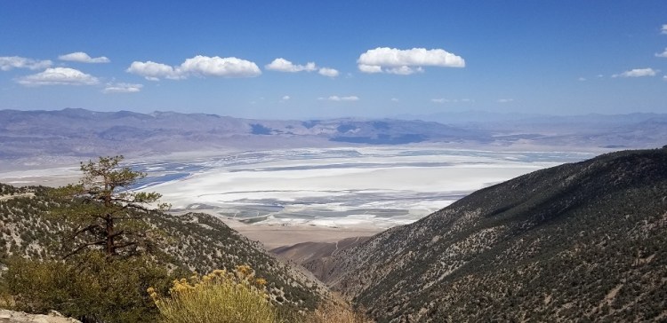
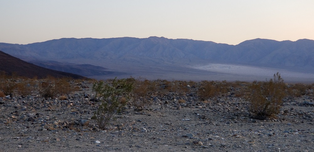
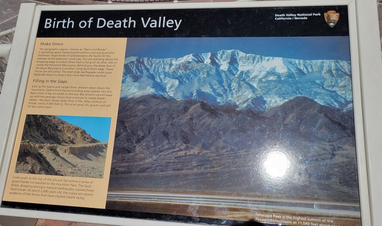
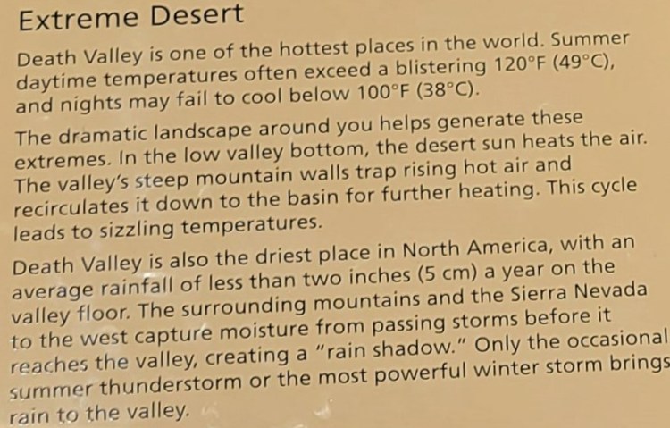
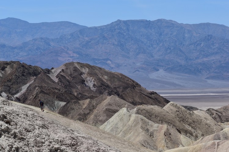
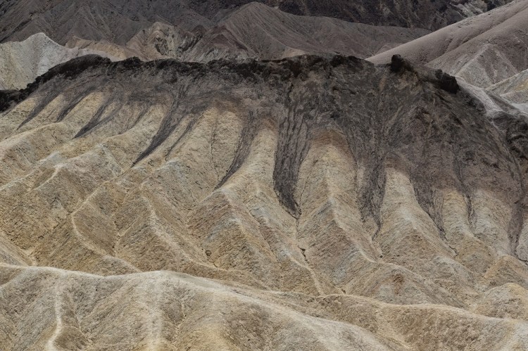
If you are intrigued by geology, enjoy rocks of many colors, shapes and sizes, Death Valley National Park is definitely for you! We were surprised to learn there are some very large and expansive mountain ranges in Death Valley. The highest is Telescope Peak at 11,049 feet above sea level. It is clearly visible when standing at Badwater Basin, the lowest point in North America. See more on Badwater below.
We enjoyed Panamint Springs and left at 8:30AM with each one of us holding one of their handmade milk shakes! Hey, the temps were already in the 80’s and we were going deeper into the desert so we figured it would be an acceptable breakfast.
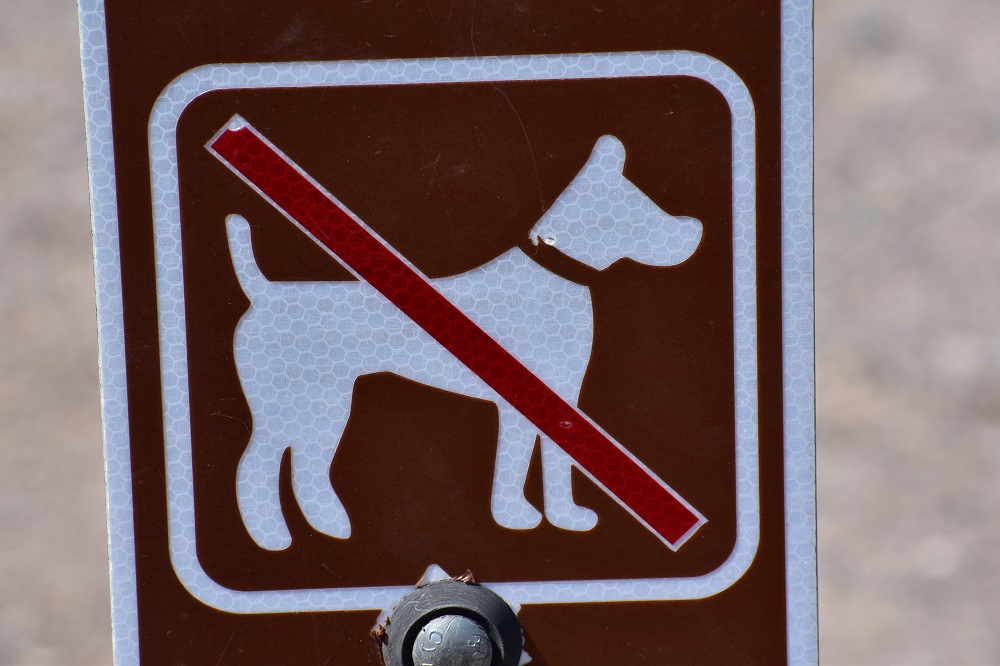
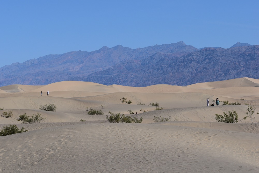
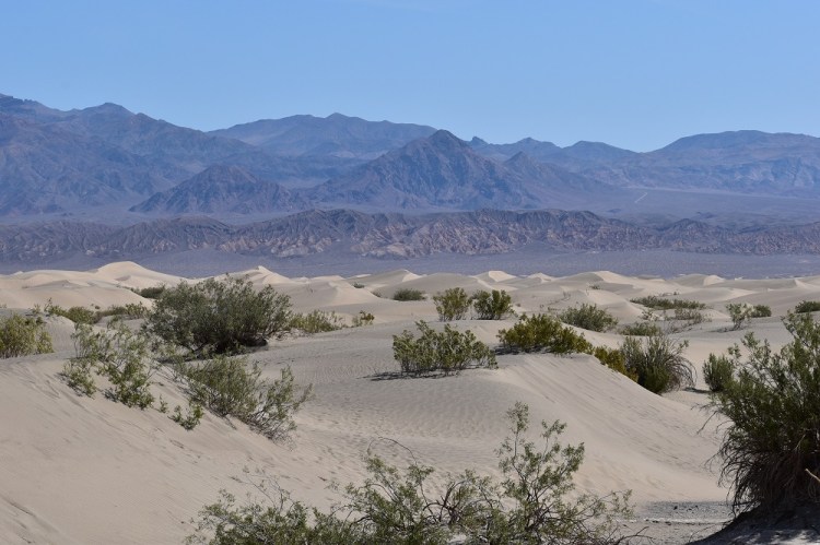
Our first stop was Mesquite Flat Sand Dunes located near Stovepipe Wells, just about dead center within the park. We have been to White Sands, Indiana Dunes and Great Sand Dunes National Parks so this was a smaller version for sure, but interesting phenomenon still the same. Unfortunately, Rangeley was not allowed on these sand piles but was on the previous three.
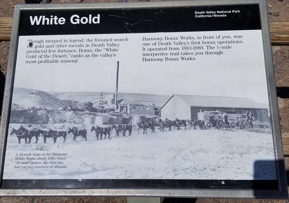
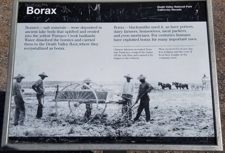
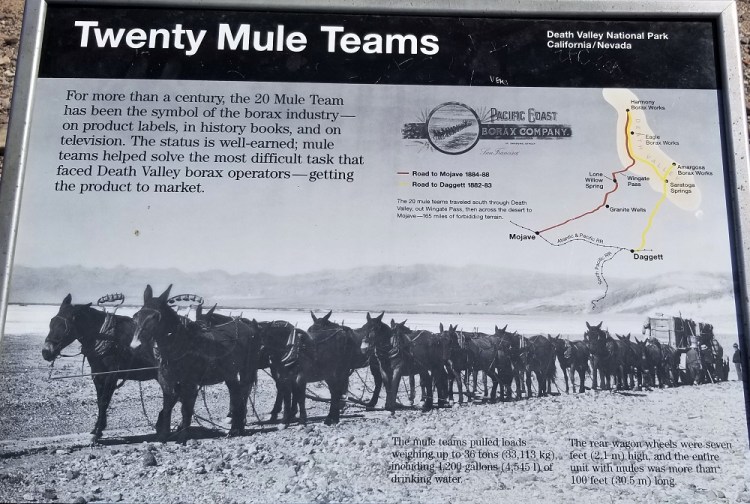
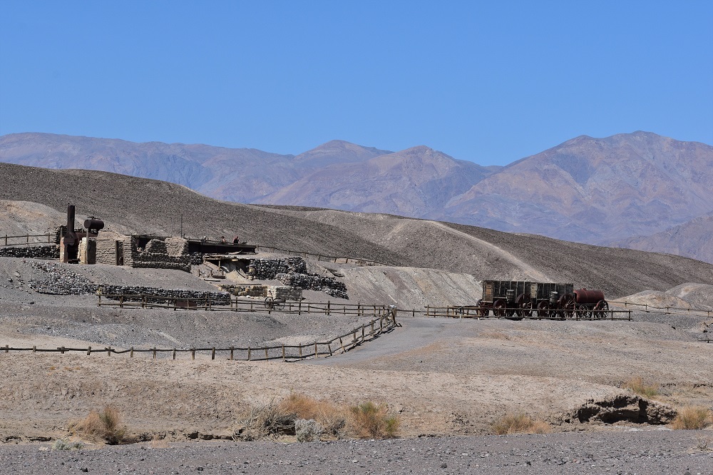
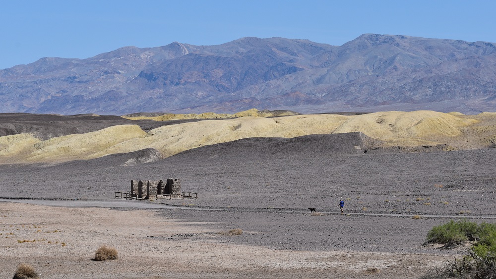
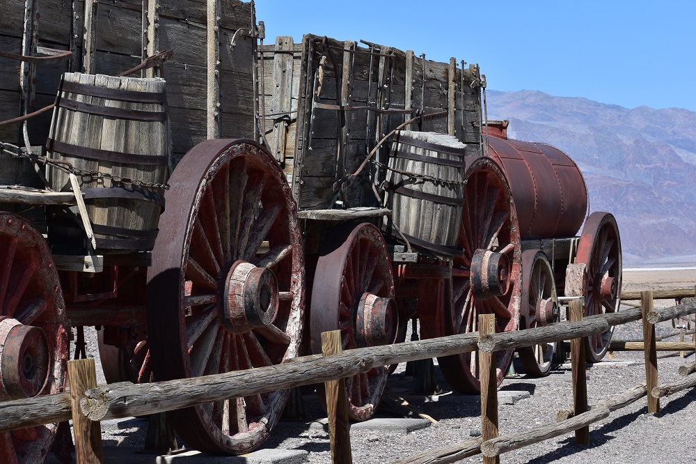
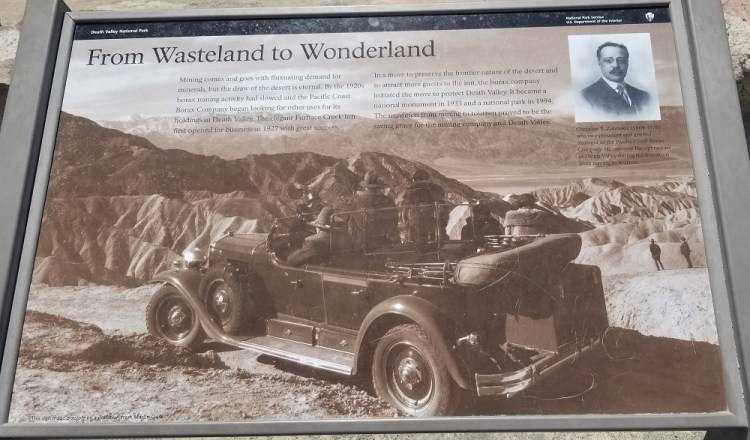
South of the sand dunes, was Harmony Borax Works. A mining camp, in the true sense of the word, where Chinese people working the collection of the ore in the mid 1800’s were over worked and under paid in this harsh, dry, scorching hot land. Driving 20 mules hundreds of miles to deliver the heavy earthen product to the railroads was a cruel and short-lived business at this particular location.
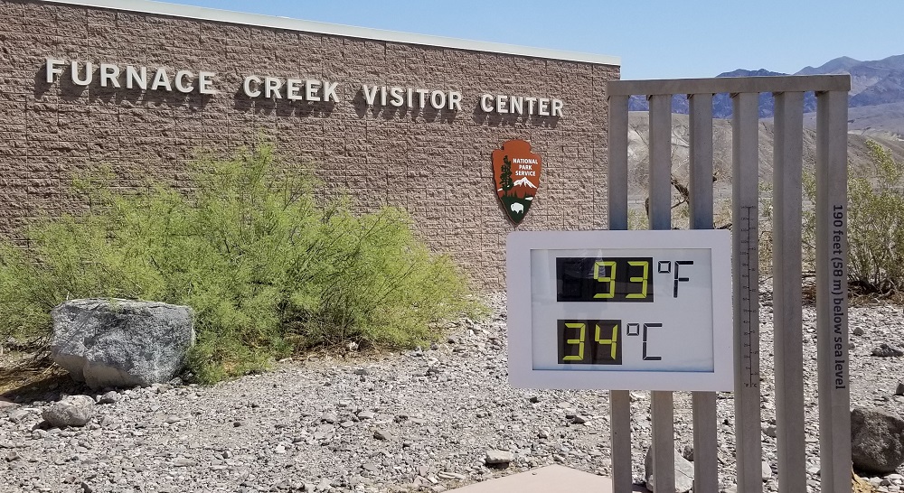
Furnace Creek Visitor Center bookstore was open for me to get my pin, postcard, park map and an ink stamp in our passport book. It too is below sea level.
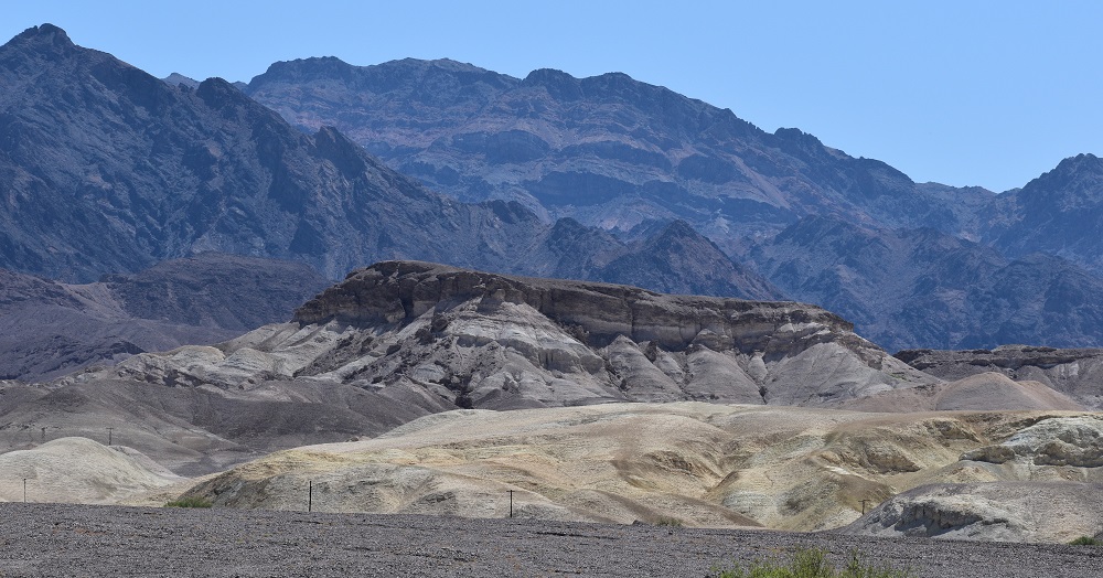
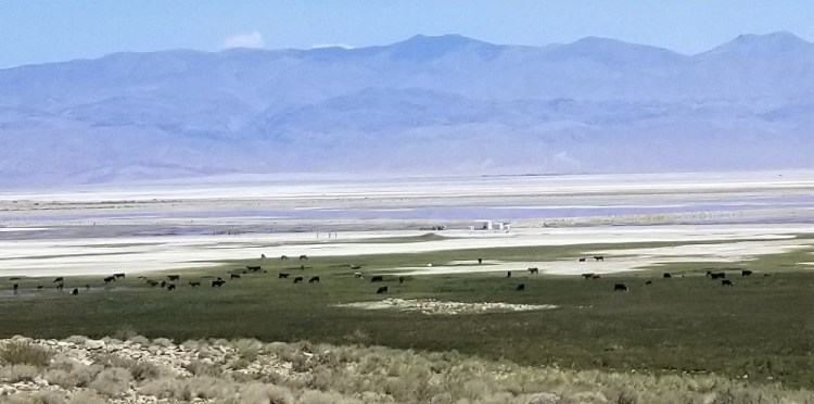
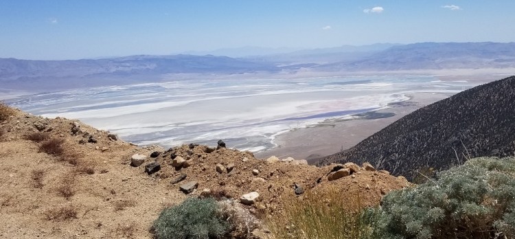
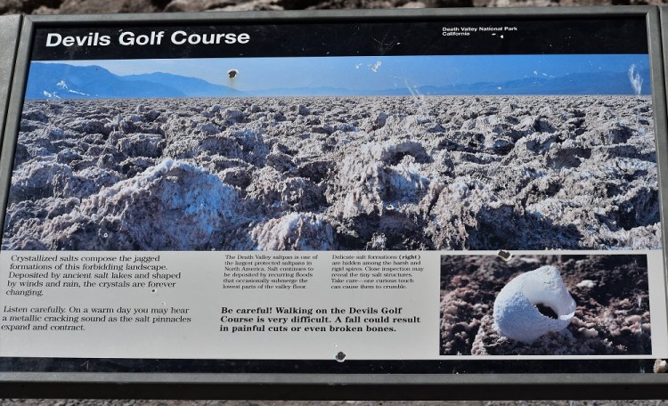
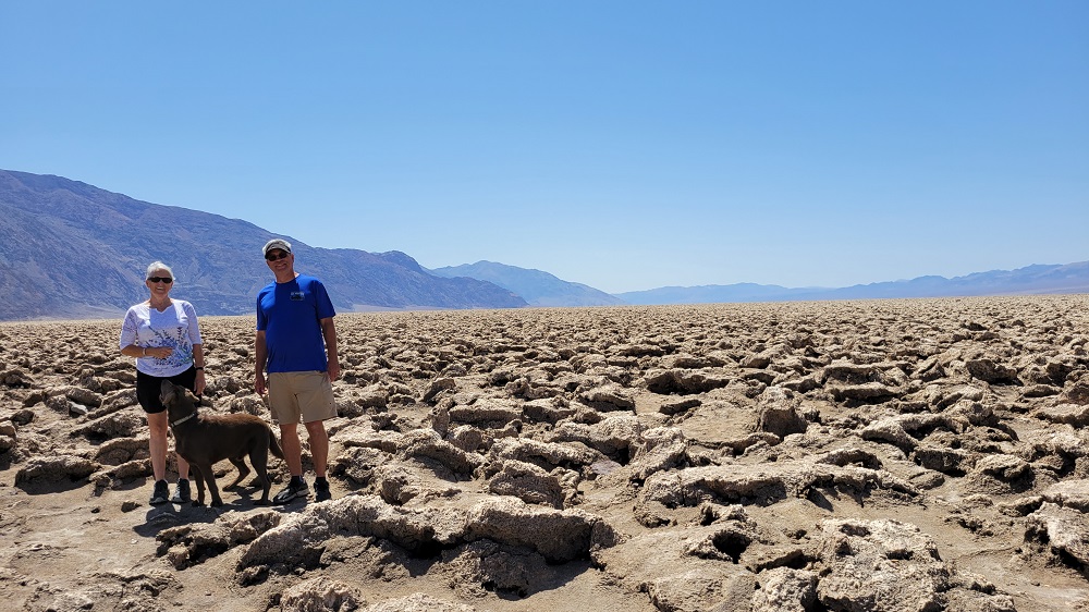
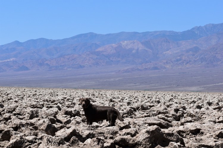
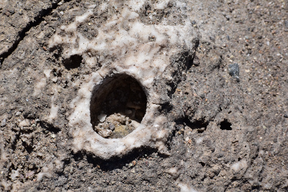
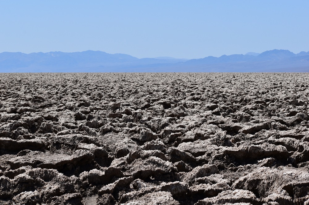
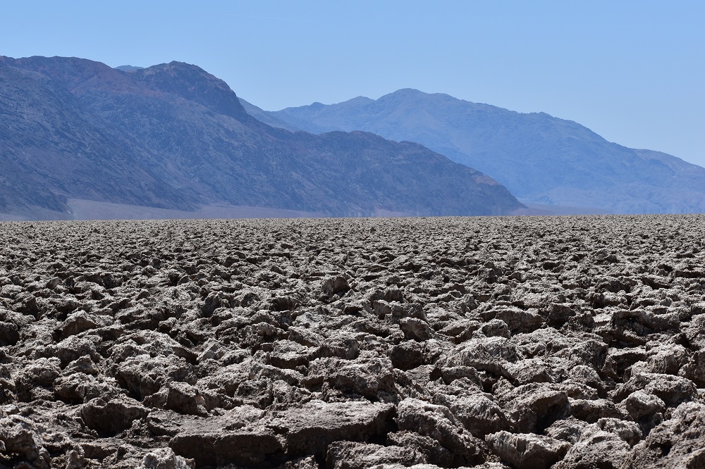
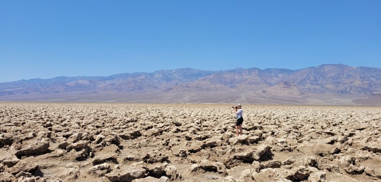
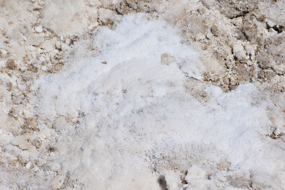
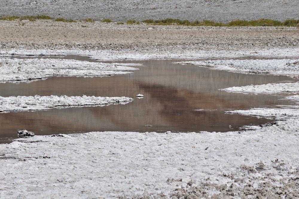
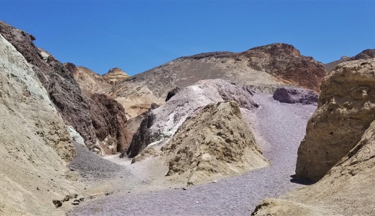
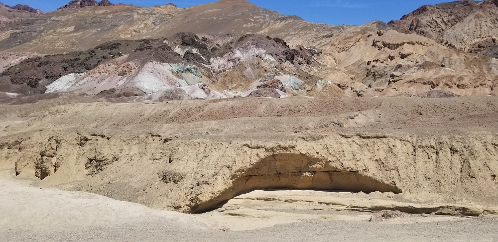
We continued on to Devils Golf Course. We were in awe of the now dry salt and mud flats and for lack of a better description, large crunchy terrain. The location of this sight to see lies between the Amargosa Mountain Range to the east and the Panamint Range to the west.
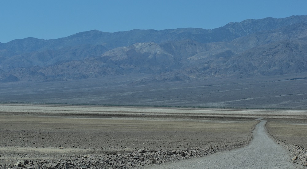
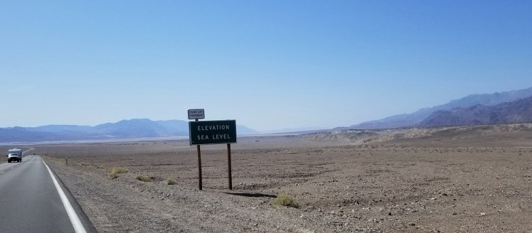
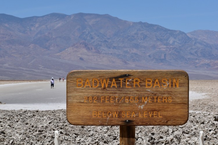
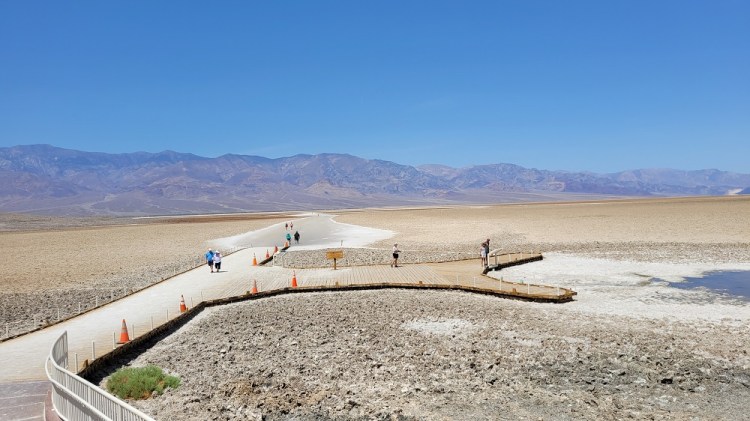
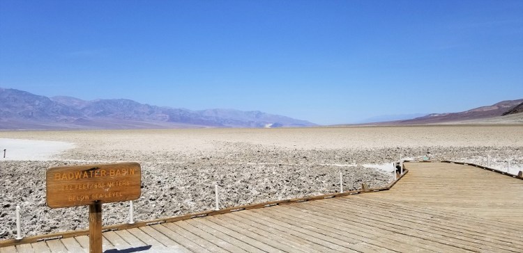
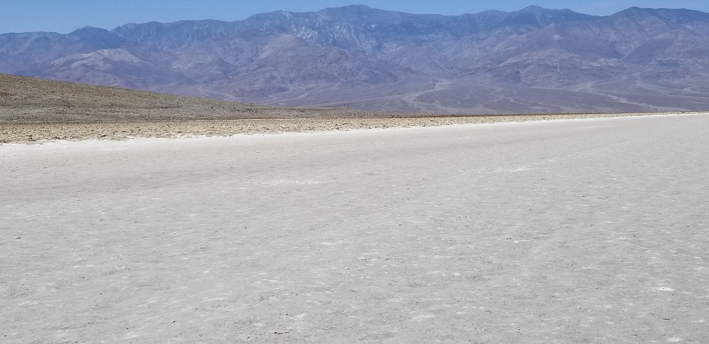
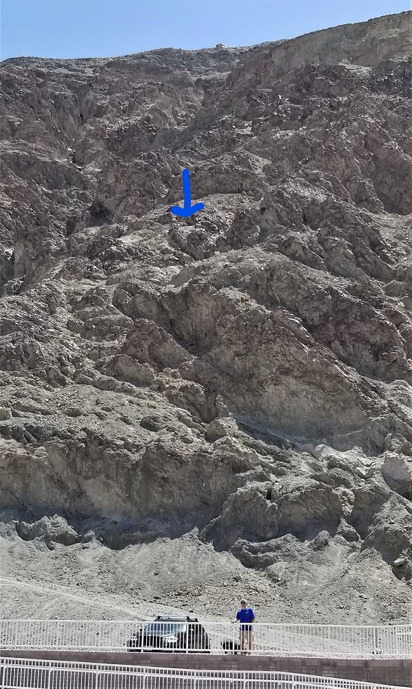
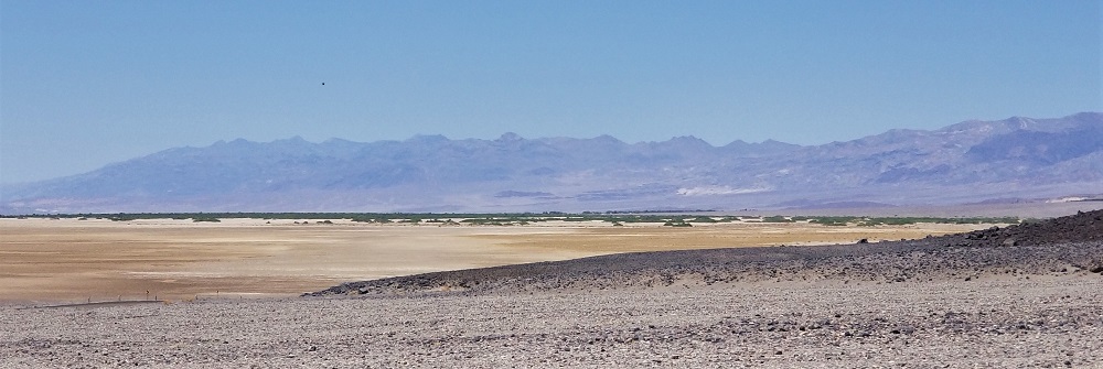
Badwater Basin is the lowest, hottest and driest location in North America! It was 97 degrees at noon while we were there. The intermittent and sprawling salt flats for as far as the eyes could see rests 282 feet below sea level. See picture to illustrate on a cliff just how much 282 feet is. We would be deep in the ocean if the basin filled with water!
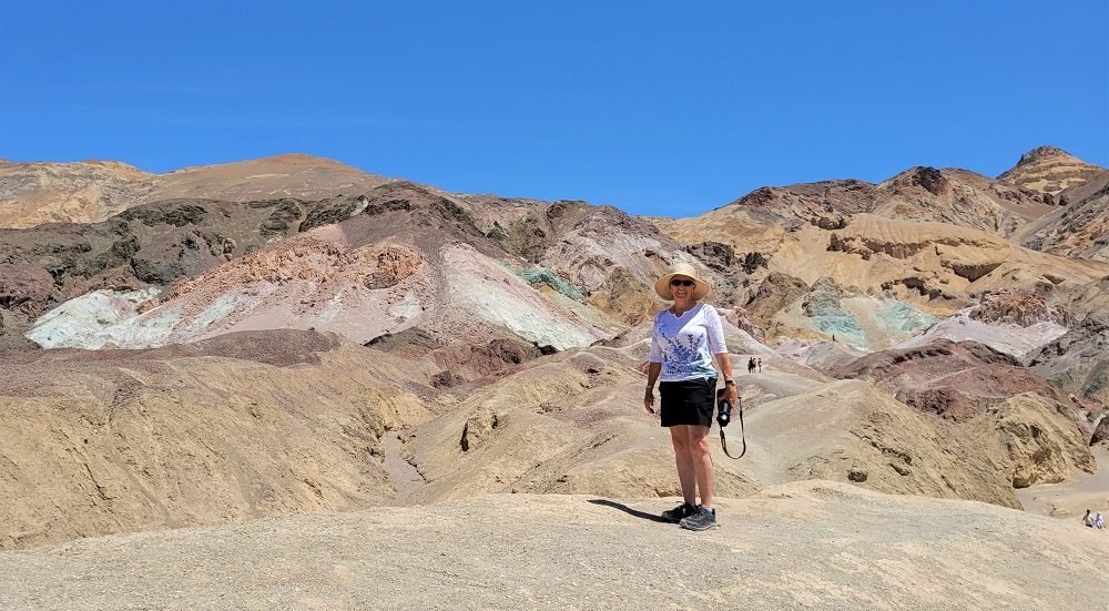
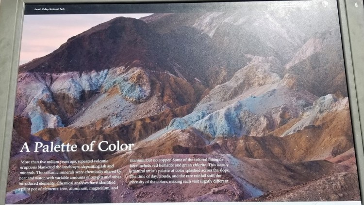
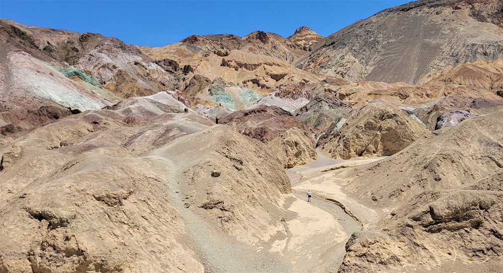
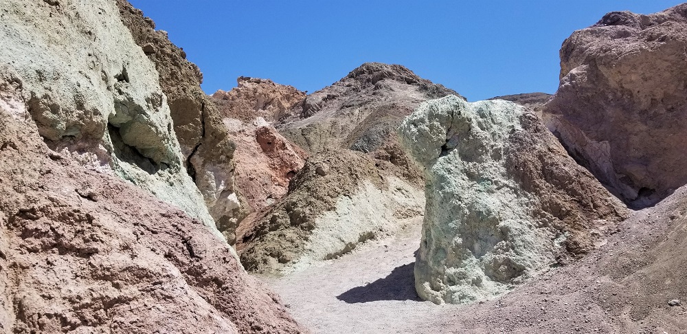
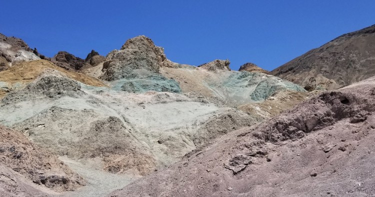
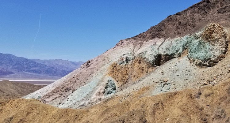
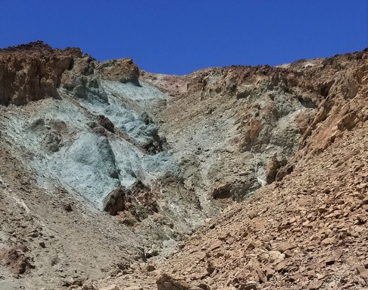
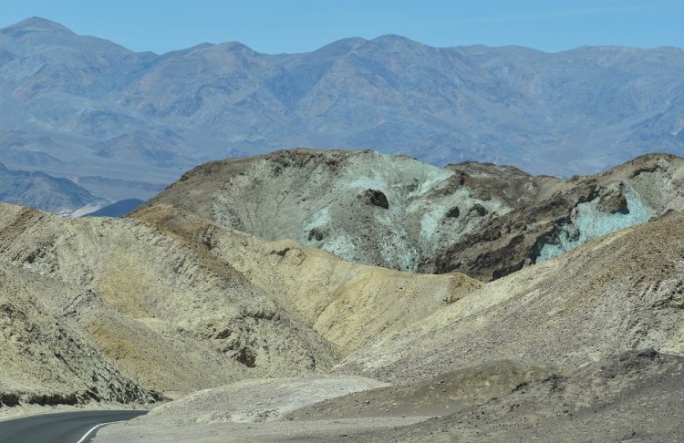
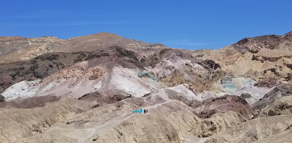
My favorite visual location in Death Valley was taking the 9-mile Artist’s Drive Scenic Loop to Artist’s Palette about halfway. I enjoyed a walk amongst the many colors left by volcanic mountains full of iron oxides and chlorite. Enjoy the pictures of Death Valley’s fireworks displays of teal, red, violet, orange and more.

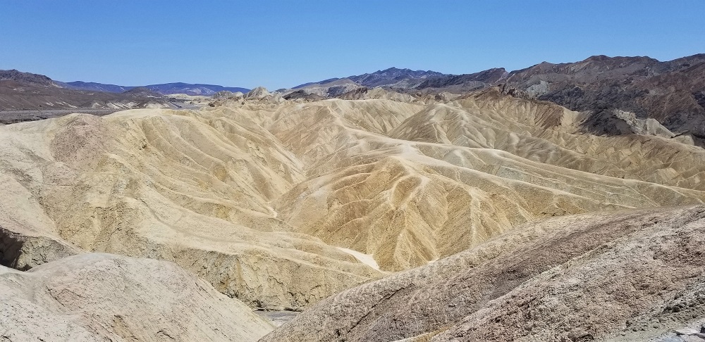
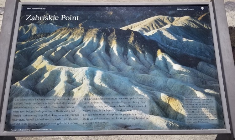
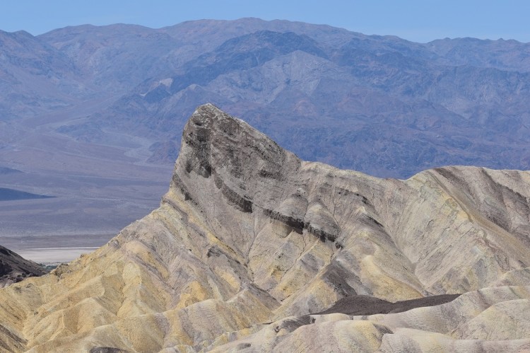
Zabriskie Point was our last stop in our last park of this trip. It was a “not to miss” show of what seismic vibrations, wind, rain and erosion can do to mountains!

We have 6 more national Parks to do in the lower 48 states, in addition to the 8 parks in Alaska. No set plans to tour them yet, but rest assured, we will be back to this website soon enough! Thanks for following along!

Not all those who wander are lost.
J. R. R. TOLKIEN
About Us
Visitors will want to know who is on the other side of the page. Use this space to write about your business.
